Today we change our perspective.
In the previous posts about time-stack construction that allows us to estimate the period and height of the waves, we have always been looking at our beach in a one-dimensional cross-section. Today we will be looking at the waves in two dimensions.
The wave direction plays an important role in multiple processes on the coast, it can drastically change the degree of exposure of our beach to storm events, changing the current’s direction and magnitude modifying sediment transport.
In short, without an estimation of the direction in which the waves arrive at the coast, the hydro-morphological analysis would be incomplete.
To illustrate, let’s travel to our favorite beach in Normandy: Etretat. The orientation of the beach is about 45° to the north in a clockwise direction. We will take two scenarios with similar energy conditions but totally different wave directions. During the Autumn-Winter session, the waves arriving at Etretat are almost perpendicular to the beach, i.e. they come mostly from the north-west direction (top image in the figure below). On the other hand, during the summer, the north wind produces waves of considerable energy that reach the beach from the north and north-east. (lower image of the first figure)
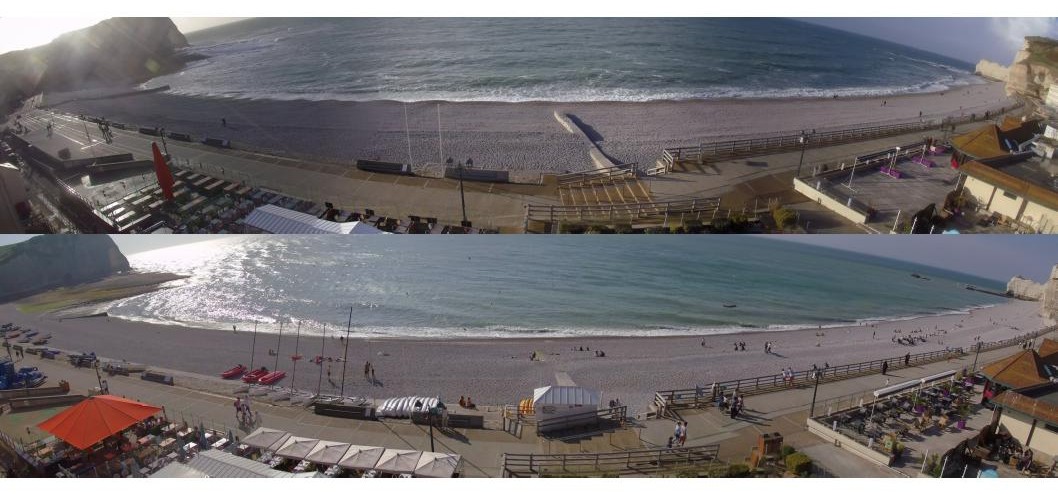
The above is what experience and models tell us, but how do we use the WaveCams tool to estimate the wave direction reaching the coast?
Well, the first step is to project the oblique images taken by our cameras onto a georeferenced image on a Cartesian plane. This means that each pixel of the image is projected on a map.
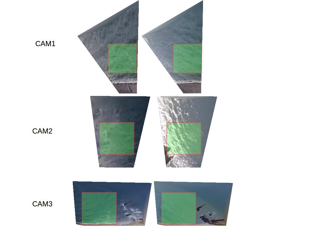
We then detect the main direction of the wave by applying a mathematical tool called the Radon transform, widely used in the medical field of magnetic resonance imaging. In simple words, this technique allows us to take advantage of the light differences, identify in which direction the image has the greatest variability and reconstruct a new image from the predominant directions. In the following images you can see the results for the examples described above.
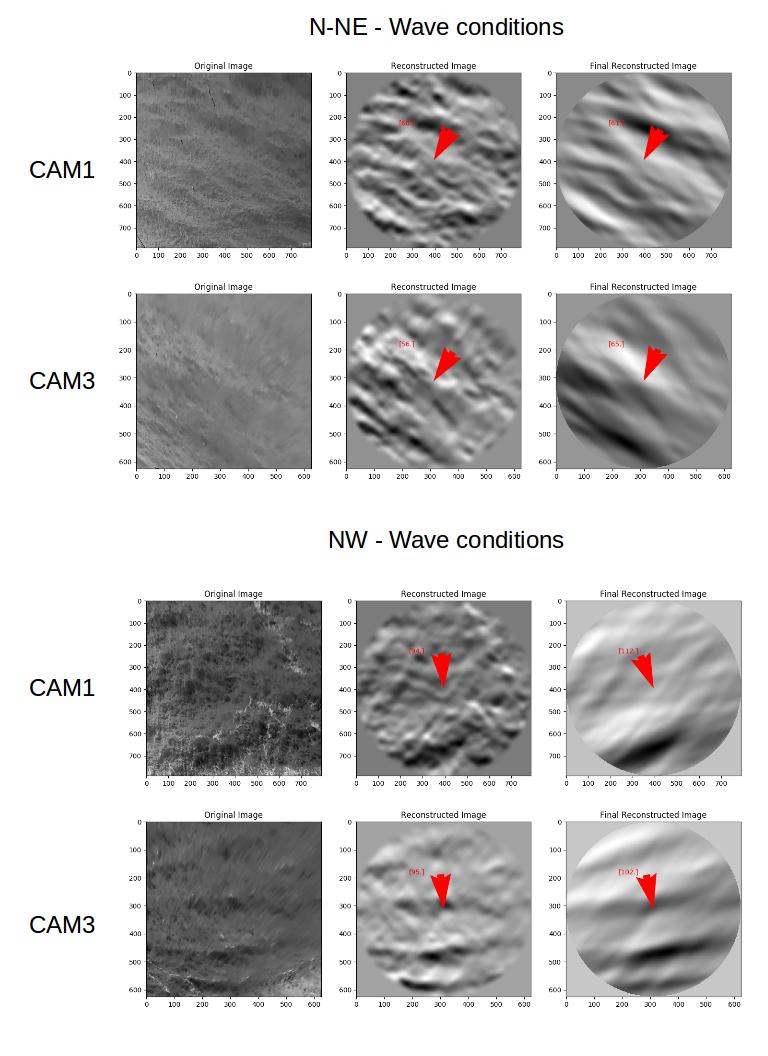
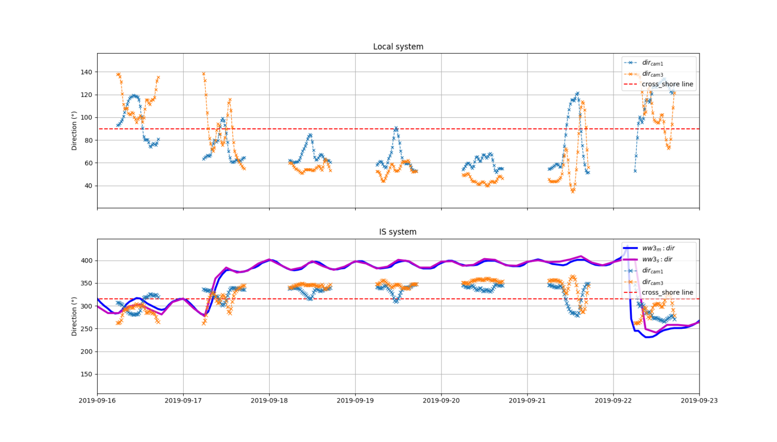
Thus, for each image recorded by WaveCams, it is possible to estimate the value of wave direction and create a time series. In the following figure, it is possible to appreciate how our estimation of the direction is able to follow the temporal evolution of the wave direction.
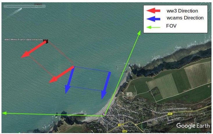
Finally, it is important to point out that the direction detected by our tool differs slightly, in value, from the model comparison due to the process of refraction of the waves “turning” while trying to reach the coast perpendicularly, (see image below).
Thank you for coming this far!! If you found this content interesting do not hesitate to contact us and share this publication!
